Civic Tech Field Guide
Donate

https://datahub.io/collections/d/itiner-e

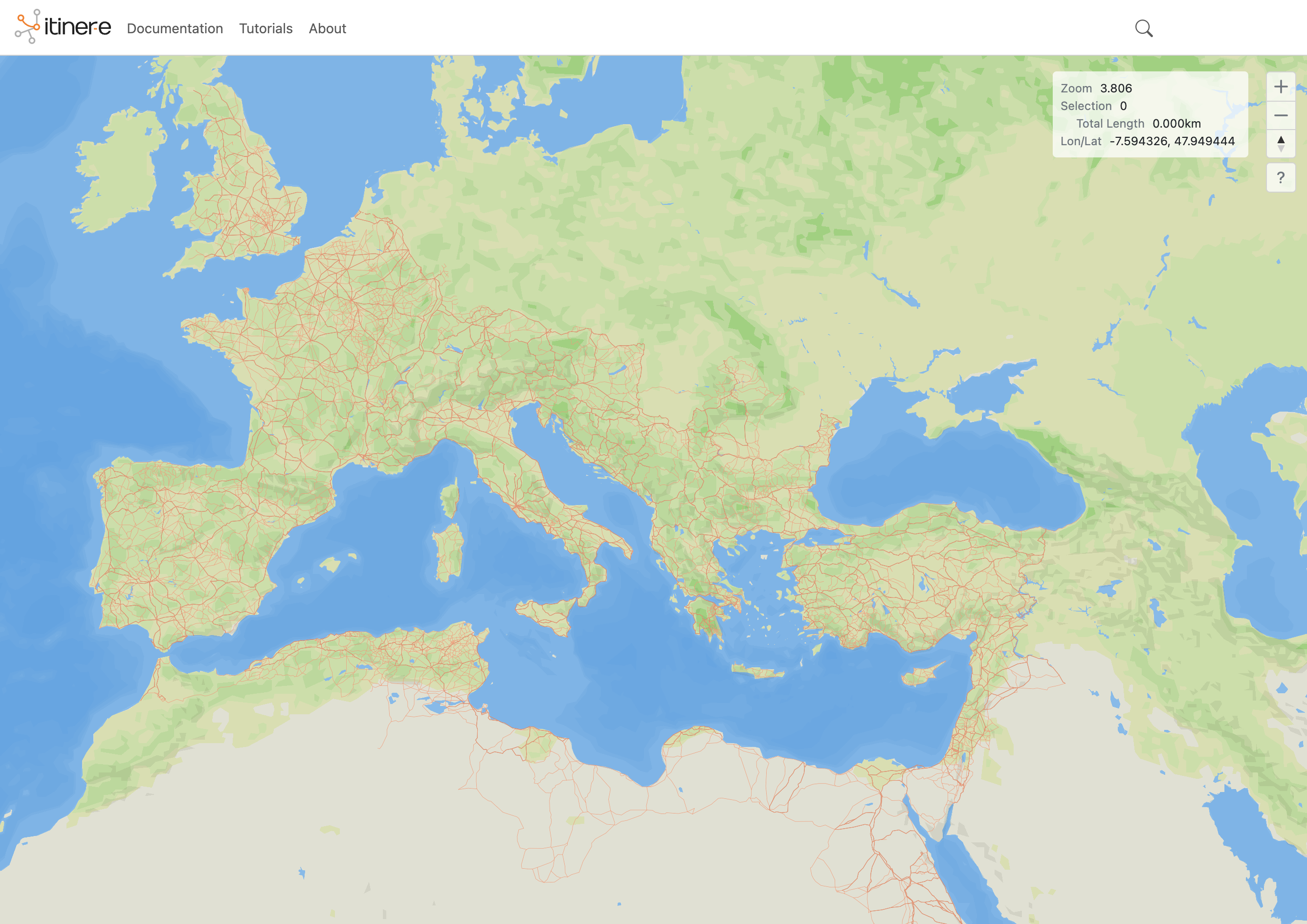
Itiner-e

A high-resolution dataset of roads of the Roman Empire

Active
Since 2025
Rome

The Roman Empire’s road system was critical for structuring the movement of people, goods and ideas, and sustaining imperial control. Yet, it remains incompletely mapped and poorly integrated across sources despite centuries of research. We present Itiner-e, the most detailed and comprehensive open digital dataset of roads in the entire Roman Empire. It was created by identifying roads from archaeological and historical sources, locating them using modern and historical topographic maps and remote sensing, and digitising them with road segment-level metadata and certainty categories. The dataset nearly doubles the known length of Roman roads through increased coverage and spatial precision, and reveals that the location of only 2.737% are known with certainty. This resource is transformative for understanding how mobility shaped connectivity, administration, and even disease transmission in the ancient world, and for studies of the millennia-long development of terrestrial mobility in the region.

Project type
Resource, Document
Founded
2025
Language(s)
English
Added
2025-12-11
Last modified
2026-07-12T16:45:23.000Z

Additional details

Number of integrations
0
Issues addressed
history, streetscape
Geographic focus
Global

More in Civic data