Transparency & Accountability Initiative Grants Database
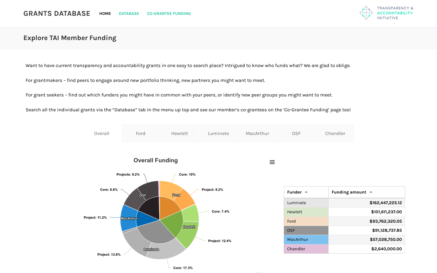
Includes funding from Ford, Hewlett, Luminate, MacArthur, OpenSocietyFoundation, and Chandler foundations totaling over half a billion dollars
1100 13th Street NW Suite 800 Washington, D.C. 20005